
|
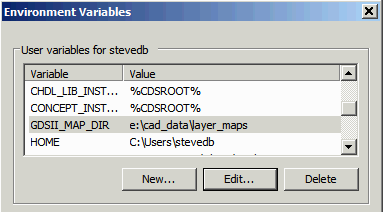
GDSII Layer ControlUsers may require NETEX-G/ODB to create GDSII data on specified layers and data types. This can be done using a layer mapping file and a simple environment variable. Environment Variable First, an environment variable, GDSII_LAYER_MAP, must be set and it should point to a directory where one or more .map files will be present. For example, if you wish the mapping files to be located in 
Creating the Map File The map file is a simple ascii text file with three columns per line. This assumes that one knows the layer names that will be used by NETEX-G. The first line is often made into a comment by starting it with the # sign. The columns are: Column 1 Either a GDSII layer number (i.e. 30) or a layer:datatype combo i.e. 30:1 Column 2 The name that appears in the NETEX-G layer stackup. This is usually either the Gerber file name (or if extracted from ODB++ it is the layer name.) Typical examples might be LAYER1. A special case is for the vias. Since drills can run all the way through a board and GDSII vias don't behave this way one must map each via layer into its own GDSII layer. The mapping name follows a specific rule:
V_M_N

    where

         V indicates a via layer

         N is the metal layer above this via

         M is the metal layer below this via
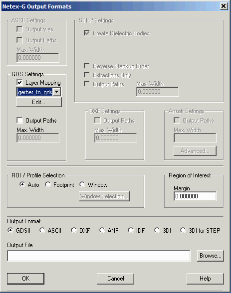
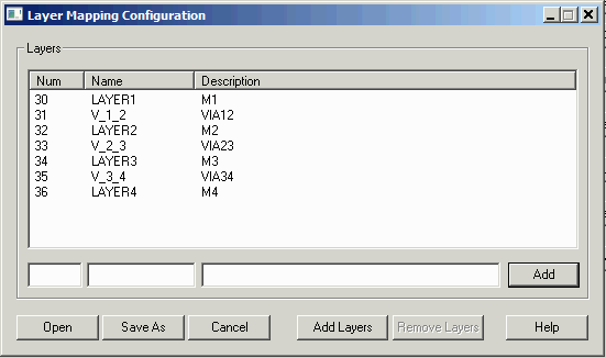
One should quote the layer names to insure that there are no problems if the layer name includes a space. Column 3 This is a description that should be double quoted. The presence of this column is mandatory but the contents are used to create a map file for Qckvu3.It is OK to merely use two consecutive quotes to hold the place. "". Sample Mapping File #GDSNum InputName Description 30 "LAYER1" "M1" 51 "V_1_2" "VIA12" 31 "LAYER2" "M2" 52 "V_2_3" "VIA23" 32 "LAYER3" "M3" 53 "V_3_4" "VIA34" 33 "LAYER4" "M4" Default BehaviorIf no layer mapping is used then by default the NETEX-G program will assign GDSII layers in stackup order starting with layer 1. i.e. the above example would look like this:1 "LAYER1" "" 2 "V_1_2" "" 3 "LAYER2" "" 4 "V_2_3" "" 5 "LAYER3" "" 6 "V_3_4" "" 7 "LAYER4" "" Enabling the Layer Map The layer map is enabled from the Netex-G Output dialog. Once you have selected GDSII as your output format the GDS Settings section will light up. Check on Layer Mapping to turn it on. If there are multiple layer map files in the directory a drop down will enable the user to pick the desired one.  If you want to create a new layer map, select an existing one as your template and then click on Edit ...  |
Download |
Benchmark Files |
Revision History |
Price |